| |
The "Hintere Gasse" (Back Alley)
is multi-day, multi-pass, high-altitude hike along the main ridge of the
Alps in the Bernese Oberland. The full
"Back Alley" is as follows:
Day 1: Meiringen - Grosse Scheidegg - Grindelwald
Day 2: Grindelwald - Kleine Scheidegg - Mürren
Day 3: Mürren - Serfinenfurgge - Gspaltenhornhütte
Day 4: Gspaltenhornhütte - Hohentürli - Kandersteg
Day 5: Kandersteg - Bunderchrinde - Adelboden
Day 6: Adelboden - Hahnenmoospass - Lenk
Day 7: Lenk - Trütlisbergpass - Lauenen
Day 8: Lauenen - Walliser Wispile - Feutersoy/Gstaad
I didn't do Days 1 and 2 (was already in that
region many times before). I did days 3 and 4 in one day. Rather than cross
the passes on days 5 and 6 I climbed the mountains towering over the passes.
Days 7 and 8 I did in one day again (with a little additional detour).
The usual change of altitude is 1,500 to 2,000m a
day. |
 |
Days 3 and 4 (done in one day):
Hike from Mürren via Serfinenfurgge (pass), across the Gamchi Glacier, via
Hohentürli (pass) to Kandersteg (a 12 hour hike which I did in 9 hours). I
started at 6AM on a beautiful morning and had breakfast at a hut at 8AM. |
 |
View from the breakfast table (further
to the right would be the Schilthorn) |
 |
Already past Serfinenfurgge
(2,612m) looking back to the Gamchi Glacier which I crossed (the glacier is
completely covered by gravel). The mountain on the left is the Gspaltenhorn.
At the foot of the Gspaltenhorn one can barely see the Gspaltenhorn Hut. |
 |
Look back to the Serfinenfurgge (the
path is actually visible in parts) |
 |
View down the valley (Griesalp) |
 |
Look up towards Hohentürli. This
was an 800m uphill where the path actually did NOT criss-cross but did take
the vertical way up! |
 |
Look down after having climbed up
towards Hohentürli. In the back Serfinenfurgge is again visible. |
 |
The Hohentürli Hut (2,778m) |
 |
View from the Hohentürli Hut to
Mount Blüemlisalp |
 |
View down towards Kandersteg |
 |
Look back towards Hohentürli |
 |
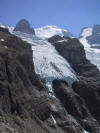
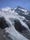
Glaciers in the Blüemlisalp
Massif |
 |
More glaciers |
 |
This is already Day 6. Rather
than to pass the Hahnenmoospass I climbed the Albristhorn (2,763m). On this
photo I look back to Bunderchrinde (the gap in the black mountain range).
Rather than to hike across the pass I climbed Mount Bunderspitz (2,546m) the
second black mountain on the left of Bundersteg |
 |
Interestingly folded layers on
the climb to Mount Albristhorn. |
 |
On top of Mount Albristhorn |
 |
The descent from Mount
Albristhorn was a very long hike along a ridge. |
 |
Looking back to Mount Albristhorn |
 |
The mountains in the back of Lenk
(Wildstrubel Massif). |
 |
Days 7/8 (which I did in one day).
I did a detour via Iffigenalp. |
 |
Iffigsee (Lake Iffig) on 2,063m |
 |
ditto. View towards
Stiegelschafberg |
 |
On Stiegelschafberg pass |
 |
Alp close to Lake Lauenen. There
was actually an Alp festival going on (not for tourists!) |
 |
ditto |
| |
I then continued down to Lake
Launen and regained altitude to pass Walliser Wispile from where I made to
Gstaad. The next day I went for a Mountanbike Ride from Gstaad to
Grieschbachtal, Rellerli then all along the ridge to Sparenmoos and down to
Zweisimmen |


